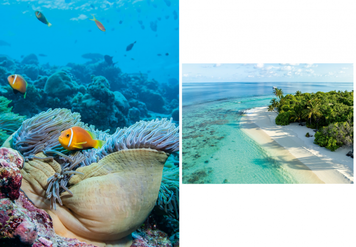
A reef can look abundant to a diver while losing changes too small or too slow for the eye to register. At Six Senses Kanuhura in the Maldives, a new monitoring system replaces occasional impressions with repeatable evidence. Three synchronized cameras capture thousands of overlapping images across a fixed plot; photogrammetry converts them into a measured 3D model; artificial intelligence helps identify and track individual colonies over time. The result is not a technological rescue in itself. It is a record precise enough to reveal new growth, damage and survival at the scale of a thumbnail. By turning resort dive sites into long-term research locations, the project also proposes a different relationship between tourism and marine science.
Surveying a Reef in Twenty Minutes
At Kanuhura Beru, marine biologist James Cordery swims repeated lines across a ten-by-ten-meter square while holding a pole fitted with three GoPro cameras. The cameras fire every half second, creating thousands of overlapping photographs from consistent angles. The movement resembles mowing a lawn underwater, but the output is a dense visual record rather than a cleared surface.
One survey captured 1,027 coral colonies in about 20 minutes. Cordery estimated that a traditional count would have required roughly seven hours and several divers. Speed matters because the team plans to return to the same plots every three months. Consistency creates comparison, and comparison reveals changes that a diver’s memory cannot reliably preserve.

From Overlapping Photos to Measured Space
Photogrammetry stitches the images into a three-dimensional model with measurable depth and form. On a laptop, Cordery can revisit the site after leaving the water, rotate it, zoom into a corner and compare a colony with its earlier state. During one review, a baby coral no larger than a thumbnail appeared where none had been recorded three months before. Its growth could then be measured down to the millimeter.
The Kanuhura Coral Census was developed with researchers from Newcastle University and University College London. John Stratford at UCL helped adapt the technology for resort use. The digital model gives collaborating scientists a time-stamped record of what occupied a plot, reducing the subjectivity and transcription errors associated with tape measures, slates and manual data entry.

A Resort Becomes Research Infrastructure
Marine fieldwork is expensive because teams must travel, secure boats and repeatedly reach distant sites. Resorts already maintain much of that infrastructure: vessels, dive access and resident staff who enter the water daily. Four sites around Six Senses Kanuhura now participate in the census, allowing academic methods to operate beyond a short expedition window.
That partnership does not make tourism automatically beneficial. It creates value only when access is paired with rigorous protocols, trained biologists and repeat surveys. Cordery, who left doctoral work in fish behavior at Oxford to pursue hands-on reef research, leads the monitoring on site. The resort’s location in Lhaviyani Atoll becomes useful to science because the work continues after guests leave.
Seagrass Corrects the Postcard
The same conservation logic extends into shallower water. Turtle biologist Athif Mohamed guides visitors through seagrass meadows inhabited by small fish, eagle rays and young blacktip reef sharks. Green turtles consume around two kilograms of seagrass a day before returning to rest on the reef, binding two habitats that travelers often perceive separately.
Before Six Senses assumed control of the property, plastic sheets had been placed on the seabed to kill seagrass and create the uninterrupted turquoise lagoons expected in tourism imagery. The resort has removed about four tonnes of that material in an effort to revive the meadows. Cordery hopes to apply photogrammetry and AI to seagrass mapping as well, replacing aesthetic judgment with ecological understanding.
Data Cannot Cool the Ocean
Artificial intelligence cannot stop marine heat, reverse bleaching or remove every local pressure. A detailed model is valuable because it clarifies which colonies survive, where new corals settle and how fast particular changes occur. Those findings can guide restoration and protection, but they do not substitute for action on warming oceans.
For travelers, the project changes what counts as an impressive sight. The reef shark and large tuna remain thrilling, yet a newly recorded coral colony may carry greater scientific significance. Empty metal restoration frames on the seabed also acquire context: interventions once considered sufficient can be reconsidered when monitoring shows more complex results.
Participation can also change guest behavior without turning every visitor into a scientist. Following Cordery during a survey directs attention toward small reef fish, coral crevices and the limits of the marked plot. Kayaking with Mohamed reframes dark seagrass as habitat rather than an imperfection in the lagoon. The educational outcome is precise: beauty expands when ecological function becomes visible.
The project’s strongest contribution may be continuity. A visiting research expedition can document a moment, whereas resident staff can return after storms, bleaching events and seasonal change. Repeatable imaging gives those returns a shared format. If the method spreads across resort islands, separate dive sites could become comparable long-term records while still requiring scientific oversight.
Seen from a seaplane, Maldivian islands appear as green centers surrounded by white sand and turquoise rings. The census adds another view—one assembled from repeat images, individual colonies and changes measured in millimeters. Conservation begins by making that hidden timescale visible.